The EEOICPA was passed in 2000. It provides compensation to workers who became ill as a result of their employment manufacturing nuclear weapons in the USA, as well as their spouses, children, and grandchildren. Uranium Mill in Riverton EEOICPA coverage is available for qualified former Workers and their families.
Are you eligible for compensation? If you or a family member worked at this or another DOE facility and became ill, you may be entitled to compensation of up to $400K plus medical benefits. Call EEOICPA Counsel Hugh Stephens at 1-855-548-4494 or fill out our free claim evaluation, We can help even if you’ve already filed, even if your claim was denied!
Here, we have compiled publicly available information and documentation about the facilities covered by the Act to clarify how their activities relate to the Energy Employees Occupational Illness Compensation Program Act.
Uranium Mill in Riverton
State: Wyoming
Location: Riverton
Time Period: DOE (Remediation) May 1988- September 1990
Facility Type: Department of Energy
Facility Description: Milling operations were conducted at this location from 1958 to 1963. These milling operations are covered under the auspices of the Radiation Exposure Compensation Act and are not separately covered under EEOICPA. However, DOE environmental remediation contractors performed remediation under the Uranium Mill Tailings Radiation Control Act (Public Law 95-604) at the Uranium Mill in Riverton from May 1988 – September 1990. DOE and DOE contractor employees who performed this remediation are covered under EEOICPA.
Listing:
Uranium Mill in Riverton is listed as a Department of Energy (DOE) site under the EEOICPA.
Compensation:
As of 06/07/2015, the total compensation paid under Parts B and E of the EEOICPA, including medical compensation, for workers suffering from the effects of having worked at the Uranium Mill in Riverton is $0.
Site Description and History:
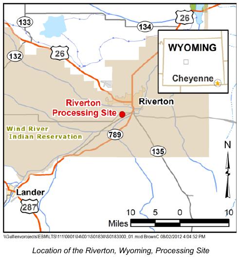
The former Riverton, Wyoming, Processing Site is in Fremont County, 2 miles southwest of the town of Riverton and within the boundaries of the Wind River Indian Reservation (Northern Arapaho and Eastern Shoshone,) on land now owned by Chemtrade Refinery Services. The site is the location of a former uranium- and vanadium-ore processing mill that operated from 1958 to 1963. The former Riverton, Wyoming, Processing Site is in Fremont County, 2 miles southwest of the town of Riverton and within the boundaries of the Wind River Indian Reservation (Northern Arapaho and Eastern Shoshone,) on land now owned by Chemtrade Refinery Services. The site is the location of a former uranium- and vanadium-ore processing mill that operated from 1958 to 1963.
Past milling operations created radioactive mill tailings–a predominantly sandy material–and uranium, radium, and thorium contamination in soils and construction debris. A tailings pile covered about 72 acres of the 140-acre site to an average depth of 4 feet. In 1988, about 1.8 million cubic yards of the contaminated materials were removed from the site and relocated to the Gas Hills East disposal site 45 miles away. The U.S. Department of Energy (DOE) completed surface remediation of the Riverton site in 1989.
Milling operations at the site also caused surface and groundwater contamination. Three aquifers underlie the site; an unconfined surficial aquifer, an underlying semiconfined sandstone aquifer, and a deeper confined sandstone aquifer. Only groundwater in the surficial aquifer has been contaminated by ore processing operations at the site.
Processing Site:
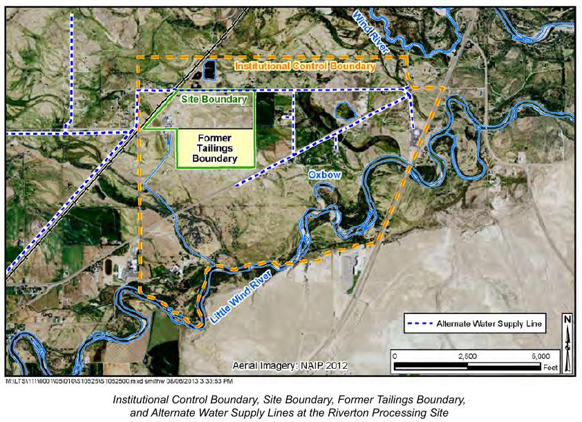
The site is on alluvial deposits between the Wind River, 1 mile north, and the Little Wind River, about 3,200 feet south.
The site is on alluvial deposits between the Wind River, 1 mile north, and the Little Wind River, about 3,200 feet south. The surficial aquifer consists of 15 to 20 feet of alluvial sand and gravel; depth to groundwater typically ranges from 3 to 6 feet below ground surface. Groundwater flow is generally to the southeast toward the Little Wind River. Samples from the surficial aquifer have shown concentrations of milling-related molybdenum and uranium measuring 10 to 40 times greater than their respective maximum concentration limits under 40 CFR 192.
The semiconfined aquifer consists of sandstone 15 to 30 feet thick and is continuous throughout the Riverton site. A layer of shale 5 to 10 feet thick partially separates the surficial and semiconfined aquifers. Concentrations of molybdenum and uranium in the semiconfined aquifer typically have been low and within the range of background concentrations.


